Bettyhill to John o’ Groats–Day Seventeen

Bettyhill in the morning

No cows on the road, but before I get into that, you can skip to the bottom and see that yes, we made it to John o’ Groats today.

Bettyhill was so beautiful that I thought I needed a morning photo as well as yesterday’s evening one. Our host entertained us at breakfast with a story about a cyclist who stayed with him last year, on his way to John o’ Groats. Not long after he left the hotel, he received a call from aforementioned cyclist asking for help. He had come round a bend going downhill at some speed and found cows on the road. Unfortunately for both him and a cow, he ran into one, fell from his bike and smashed his collarbone. The kind hotel owner stayed with him until the ambulance arrived, and looked after his bicycle. I gave husband a look, to which he replied he doesn’t go too fast around bends in the road. In the end, there were only sheep and no cows.

A glimpse of the sea on the way

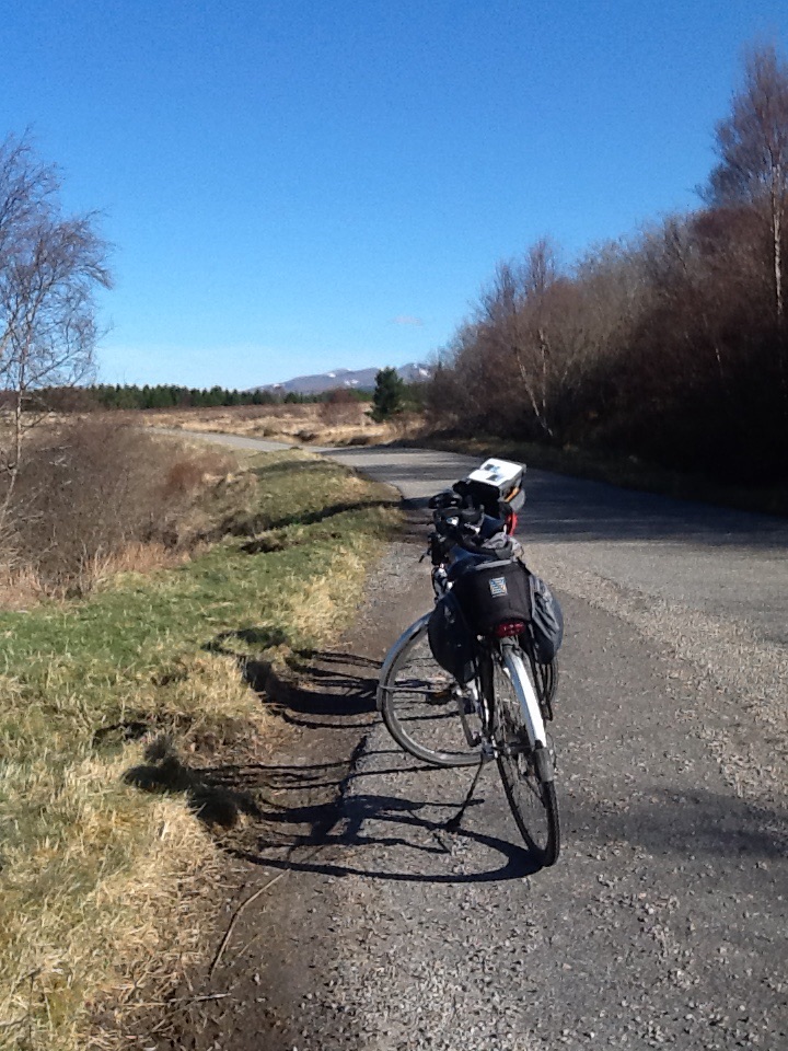
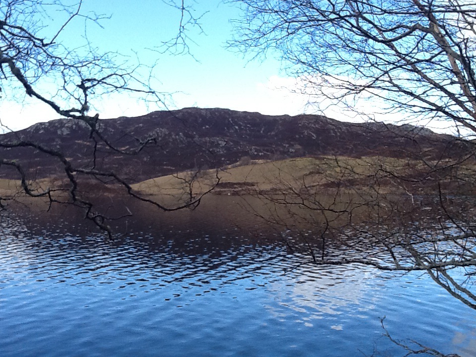
From Bettyhill, the road follows the coast, with coastal sorts of hills, some long, some steep, but lots of them for the first sixteen miles. And the dreaded headwind had returned, so it was a bit of a challenge. And we had cold feet. It’s not really spring yet in northern Scotland.

Lots of phone boxes in remote parts of Scotland. No mobile coverage in most places.

After Caithness, the road flattened, but the headwind never stopped. Husband very kindly offered to go in front after I petered out early on, so I had the advantage of his shelter. I’m not sure we go fast enough for it to be a slipstream. I do have to concentrate quite hard to stay very close but not crash into him, and not to be left behind.

Not our road, but still daffodils in bloom

For the first time we had a deadline for arrival at our destination, due to the complicated travel arrangements mentioned yesterday. We were being collected at 3:00 to be driven to Inverness so that we could catch an early  morning train on Monday. I wanted to arrive at John o’ Groats well before, in time for photos and to drink in the views and atmosphere of our final destination.

Dounreay Nuclear Power Station, in the long process of decommissioning

We had never yet arrived anywhere at 3:00, though it was certainly easily possible if we set our collective minds to it. And so we did. I still stopped for photos, for the occasional fueling break in addition to the fuel I ingested  as we cycled. It did help that it was cold and cloudy, so not conducive to a long picnic lunch.

Not beautiful landscape, especially on a rather gloomy day
Not a beautiful landscape, especially on a rather gloomy day

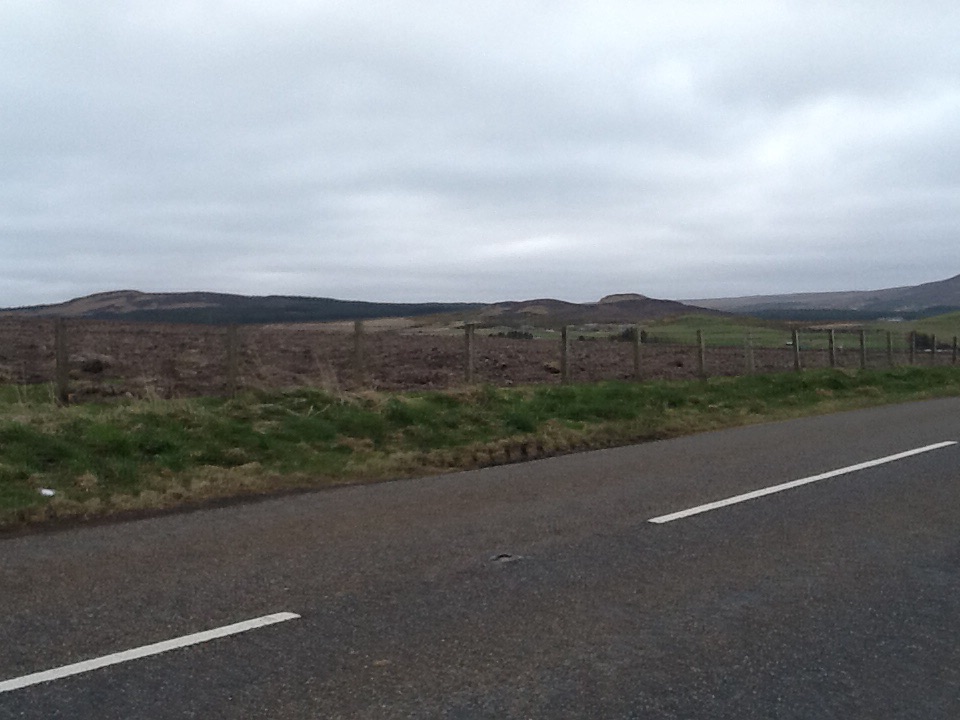
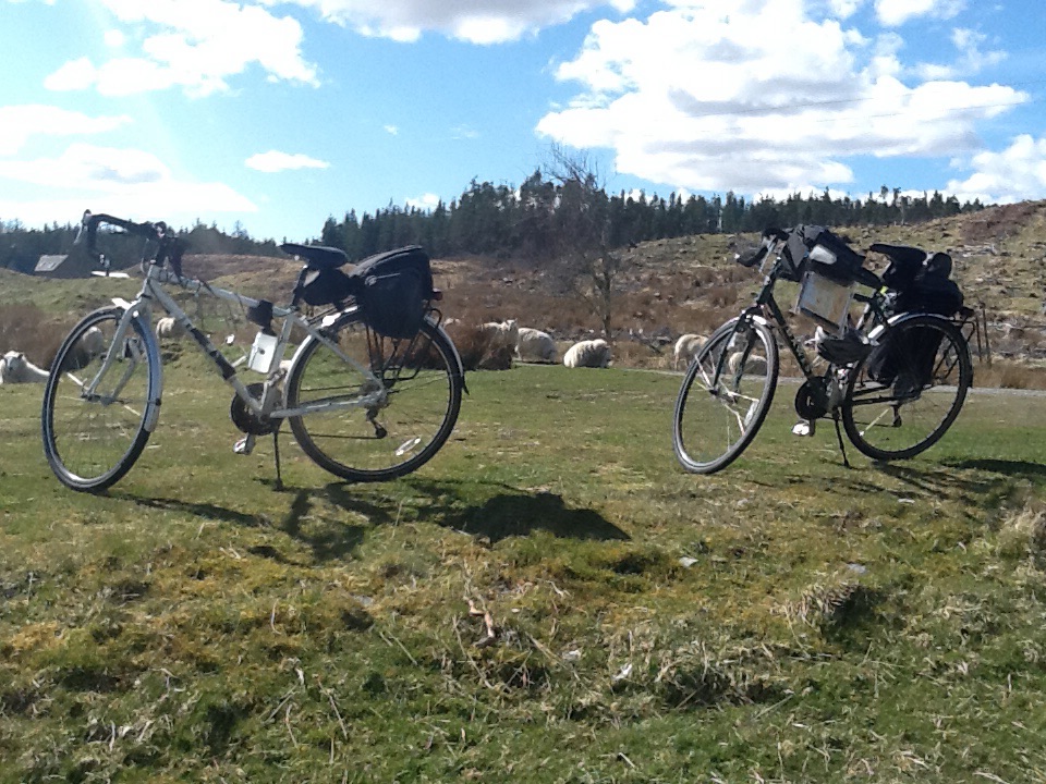
It also helped that the landscape wasn’t the most beautiful after we left Bettyhill. First it was a bit bleak, then more fields of sheep. But the bleakness must disappear when the brown heather blooms into colour later in the year. And I never get tired of watching the lambs.

This one caught my eye as I went by

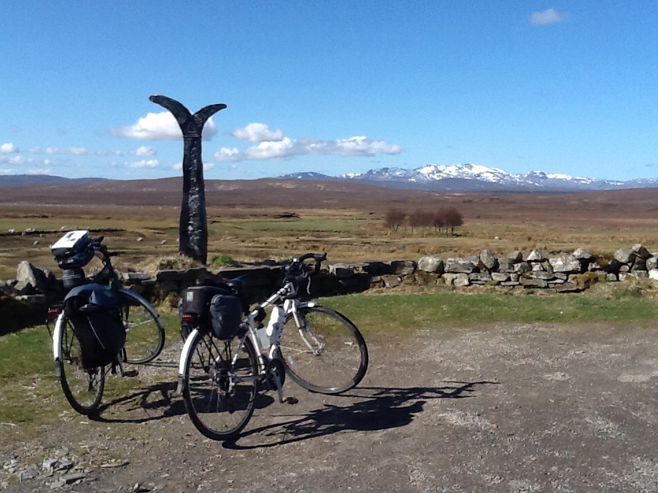
We saw these sculptures in a small wood as we went by, stopped and looked up to see dozens of crows’ nests and a cacophony of caws.

Easy to miss in the woods, but one of the advantages of bike speed
A parliament of crows, a real racket, and dozens of nests above
A murder of crows, a real racket, and dozens of nests above

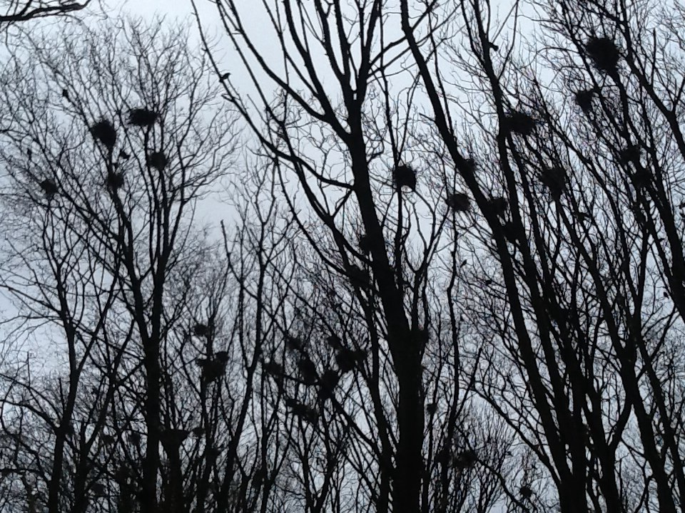
As we continued, we came across two more colonies of crows. Wouldn’t want to live nearby, but also didn’t realise that they nest in flocks.

Thurso, a surprisingly large town for the upper reaches of Scotland. There was a Lidl here!

Thurso is much bigger than anything we had seen since Inverness. It does have a train station, but we’re not sure what supports it through the winter, unless the residents are employed by the nearby nuclear plant.

The landscape just kept changing every few miles, sometimes bleak with heather, then farms and sheep, then this

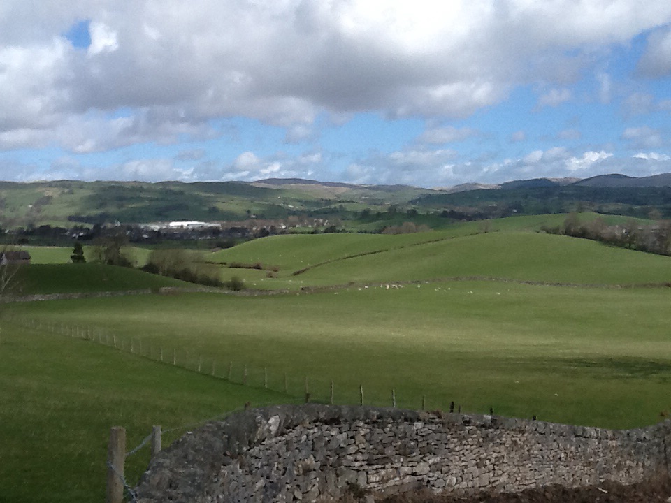
We did stop by the shelter of a stone wall for half of our lunch, one of the best we have had when we have asked for a packed lunch from the pubs or hotels where we have stayed. Usually we just get a sandwich and maybe crisps, but today we had a sandwich, banana (eaten well before now), crisps, shortbread fingers and a full sized Mars bar. During all of our cycling, food has become fuel, necessary two hours after breakfast and then pretty much every hour until lunch, then after another two hours if we are still going. Then tea before dinner, with cake if possible.

And then...
And then…
We arrived
We arrived

After our half lunch, it wasn’t long before we arrived at the end, just over 50 miles from Bettyhill and over 1000 miles from Land’s End. We had expected the total to be a bit under that, but we had some navigational errors that added miles, plus the miles from Penzance to Land’s End when we began.

1005 miles later
1005 miles later
We didn't forget to take photos!
We didn’t forget to take photos!

We didn’t set any records, and have nothing but respect for those who have. But ours was a different kind of journey, to see the UK from bottom to top, slowly on bicycles. And we did that.

Bonar Bridge to Bettyhill–Day Sixteen

Leaving  Bonar  Bridge, watching the fog lift
Leaving Bonar Bridge, watching the fog lift

It was a foggy and bitterly cold start to the morning, but the sun managed to burn through and it quickly warmed up. Down to three layers today!

Above the Falls of  Shin
Above the Falls of Shin

Cycling today was nothing short of perfect. We had sunshine, blue skies and first beautiful and then spectacular landscapes. The roads were quiet and often single track, with hardly any traffic. Who would be travelling in this remote part of northern Scotland? We did go through Lairg, which was a bustling village with a Spar shop. After that there was nothing for  the next 45 miles.

Quiet road on the way to Crask
Photos of roads...but so perfect for cycling
Photos of roads…but so perfect for cycling
that I have to have two of them!
The Crask Inn, well known amongst cyclists and walkers and now for sale, if someone wants to be really far away from anywhere.

Nothing until the Crask Inn, in Crask. Which pretty much just has the Inn. An important point for cyclists and walkers, it is for sale. It is as remote as an Inn can be, and we were trying to imagine who would buy it and where the owners would go after living there for a long time. Husband just said “No”.

Sustrans marker showing maileage from Crask Inn to John O'Groats
Sustrans marker showing mileage from Crask Inn to John O’Groats

Our route guide describes the next part of the journey as providing some of northern Europe’s most sensational cycling, and not having been in other parts of northern Europe, I would wholeheartedly agree. We took our time, not having a long day ahead, took loads of photos and saw what we think were two golden eagles and two oyster catchers.

Grand landscape from Crask

image

Reflections in Loch  Taver
Reflections in Loch Taver

We cycled along Loch Taver and the River Taver, exquisite in the sunshine. I also learned something of Scottish history, as Strathnaver was part of the area where the Clearances took place. With the appearance of the Cheviot sheep from the south borders, a hardy type that could live year round off the hills, the wealthy landowners cleared out the small farmers in order to take over the land for large herds of Cheviots. We think that’s what we were seeing today still. The small farmers were evicted from their homes with no warning and often nowhere to go, so it was a dark time in Scottish history.

We looked for a long time
A stop for lunch and the sheep got curious...
A stop for lunch and the sheep got curious…
and stealthily crept up behind us.

After lunch we stopped at this memorial to Donald Macleod, who wrote about the Clearances, as it wasn’t widely known how they had been enacted. People in general had thought the landowners were making “improvements” and that it was good for Scotland.

Monument to Donald Macleod, who experienced and wrote about the Highland Clearances.
A corrugated iron church at Syre built as a mission church in 1891
Bettyhill, our penultimate destination

We are staying in Bettyhill, in a beautifully situated hotel above the River Taver as empties into the Atlantic Ocean. There is even a beach, but we can’t imagine it ever gets warm enough to swim.

We leave for John O’Groats tomorrow, and then have some complicated travel arrangements to get us to Inverness tomorrow evening, so we can catch an early train on Monday. Apparently someone didn’t want to get home too late on Monday. And John O’Groats is more miles from anywhere than Land’s End.

I have now had two dreams that we got to John O’Groats and forgot to take photos. So we definitely won’t forget tomorrow.

Loch Ness to Bonar Bridge–Day Fifteen

Loch Ness from the east side

The morning began with a lovely gentle ride along Loch Ness heading to Inverness. We picked up the National cycle path soon after, which took us through Inverness. There were roadworks on one through street and there had been a big fire recently resulting in another through street being closed. But someone saw us looking perplexed and kindly directed us through the chaos.

Inverness. Opposite direction
Inverness, from the bank of the River Ness
Inverness, looking down stream

Cycling through to the bridge reminded me of Bristol on a smaller scale, through the industrial area where we miraculously found the bike path again, directing us onto the Kessock Bridge. In contrast to Bristol it was a clear day, and though apparently you can sometimes see dolphins and porpoises in the Moray Firth, we saw no signs of them.

View...
View…
From the Kessock Bridge, from Inverness
from the Kessock Bridge, from Inverness

We did, though, have a wonderful view all round. We continued on the bike path on the other side of the bridge, and stayed on it most of the day. Sometimes it was a path next to the main road, sometimes it was a quieter, smaller road. We eventually left the cycle route to take a B road known as the Struie. It was a bit busier than I would have liked, and perhaps has become busier since our route guide was written. There is an almost fifteen mile ascent, gentle at times but occasionally steep.

How do you think they voted in the Referendum?
How do you think they voted in the Referendum? The road on the way to the Struie.

The landcape was very different from yesterday’s, when we were still in the lochs and glens. Today there was a lot of arable farmland, some sheep and lambs, but mostly hundreds of acres of arable, still brown, being prepared for sowing. On the Struie, there was forest land after the agricultural, then the remains of lots of logging, and pine forests planted for future logging.

Just after the top of the   Struie
Just after the top of the Struie

Past the planted pine forests, as we neared the top, the landscape became more natural if bleak. The blue sky helped, but it is a vast vista, broken only by mountains in the far distance.

Viewpoint on the way down on a clear day

We eventually got our swift descent, which was a relief after so much climbing. But the climbing seemed to go on forever; the descent was over in minutes.

Bonar Bridge from the town

Shortly after, we arrived in Bonar Bridge, a bigger than expected town, where we are staying at the Dunroamin Hotel. A real contrast with our luxury of two nights ago, though there are two labradors and the owners are very kind. Apparently they have had all kinds and all ages of cyclists. It is the right distance from John O’Groats for some people to ride in a day (just over 100 miles). We’ll be riding it in two.

Glencoe to Loch Ness–Day Fourteen

Leaving Glencoe
Leaving Glencoe

The day started with Charles Kennedy and ended with Danny Alexander, the only indications that there is an election about to happen. But the views were of course more impressive than the signs of an election. Glencoe is one of the most beautiful places, but we were overwhelmed with our surroundings at every moment today.

Neptune's Staircase
Neptune’s Staircase, a series of eight locks on the Caledonian Canal,  Fort Williams

On the A82 again to Fort Williams, where we crossed the Caledonian Canal and saw the famous Neptune’s Staircase. Then it was off onto a quiet country road. We could occasionally see the Canal below us in the distance, but being a bit higher had a stunning vista as we cycled quietly along.

B8004, running above and alongside the Canal
The brown dot is a deer, living happily with the sheep and lambs
The brown dot is a deer, living happily with the sheep and lambs.

We stopped to watch another lamb drama, though this one was just funny. Twins running looking for their mother, who was happily grazing at the top of the hill while they were trying out all of the sheep at the bottom. Eventually she called to them and they came bounding up the hill together and found her.

My favourite view of the day, still reflection

The day was a bit warmer and so still. After out harsh wind of yesterday, it was such a relief, and it resulted in scenes like this one, where the hills are reflected in the still waters.

After that serenely beautiful country lane, we joined the The Great Glen Way, mostly for walking but cylcling allowed as well. We have been following a route husband found on the internet through Sustrans. It has been meticulously detailed in its directions and has directed us onto some of what must be the quietest and most beautiful lanes in the UK. However, this time, encouraging us to follow the Great Glen Way for 7 1/2 miles, along a stony track, was a mistake. Going up steep hills our rear tires spun on the gravel, going down was a fright and cycling along was bumpy, uncomfortable and I stared at the track looking to avoid holes and large rocks.

Forest track, the Great Glen  Way
Forest track, the Great Glen
Way. Half of this is the reflection in the water of Loch Lochy

It took us well over an hour and though we had some pretty views, I would have exchanged them in a minute for the A82. Almost, but not really, making it worthwhile was meeting an elderly gentleman (whose wife had gone ahead while he “yapped”) who had spoken to a young man about to go off in a canoe who was trying to break the record for catching trout. Current record stands at 32 pounds. Chatted away about the head of the Cameron Clan and a couple from New Orleans who had been cycling here as well until he finally went off to find his wife.

Forest view Great Glen Way
Marina at Laggan Locks

This (above) was finally the end of the gravel/stone path and the beginning of long distance cycling dreams, tarmac! The Marina in the distance has a lock, and we waited while a boat went through and then spoke to a man who was travelling by bicycle in the opposite direction to us. We warned him about the surface of the Great Glen Way and in exchange, he told us that the cycle path we were about to get onto was a construction site. So we went back to the A82, with which we have become very familiar over the last few days.

After taking so long on the Great Glen Way, we were happy to be moving at a respectable rate of speed again. But also getting hungry. As pretty as the morning had been, there were no opportunities to buy sandwiches, so we were happy to see this store ahead, the Well of Seven Heads Store, advertising hot and cold food, as well as delicious cakes.

The Well of the Seven Heads Store, our lunch stop

It was a perfect stop, and had eveything advertised, including the daughter of the shop owner, who was very friendly and very impressed that we had come from Glencoe and that we were still going to Foyers. Gives one a sense of accomplishment.

The Seven Heads
The Seven Heads
View from the store where we ate

The road wasn’t terribly busy again, but not long after we turned off onto the road below, anticipating what our route guide said would be memorable as our hardest and longest climb of the entire End to End route. It lived up to expectations, but wasn’t impossible.

Road leading to the steepest, longest hill of the route

It was over five miles of climbing, but the first mile was by far the worst. After that, it didn’t seem too bad. And about three quarters of the way up was Loch Tarff. The road is single track for much of the way and very quiet. It is just out of Fort Augustus, called General Wade’s Military Road, first built as part of a network by General George Wade between 1725 and 1733. There’s more to the history but that is enough for my purposes.

Loch Tarff
Loch Tarff
Loch Tarff
Loch Tarff

From Loch Tarff, we were close to the top. We stopped to watch a sheep and lamb (again) ambling down the middle of the road, trying to decide which side to go to. Shortly after, we saw a herd of highland deer.

Made it to the top, phew!

And then we were there. Along with a New Zealand cyclist who lives in Scotland and a car full of people come to see the view. The whole day really had been stunning, and this was a fitting finale. From here it wasn’t far to Whitebridge at 30mph and then to Loch Ness, where we are staying.

The Wade Bridge at  Whitebridge
A Wade Bridge at
Whitebridge
Explanation of the  Wade Bridge
Explanation of this
Wade Bridge

We thought we were staying at the same hotel we had stayed in thirty years ago when we were cycling through the UK, but it turns out to be a different one, very close by with a very similar name. The owner is chatty and freindly and just came in to say that the lake and mountains looked amazing at 9:30 with still some light in the west.

She was right. Magical time and place, though no sightings of Nessie.

Loch Lomond to Glencoe–Day Thirteen

Early morning and a thought...but the bikes wouldn't fit.
Early morning and a thought…but the bikes wouldn’t fit.

We left the hotel under a mixed sky, but fairly certain that we would have a dry if not sunny day. We rejoined the cycle path just at the entrance to the hotel (very good planning on husband’s part) and headed off up the west side of Loch Lomond.

Blue sky above
Blue sky above Loch Lomond

For a while the cycle path was the old road that is now the A82, running parellel but directly next to the lake. It was luxurious, having a whole road to ourselves, and thinking what it was like when this was the only road going north.

Not long after, we rejoined the A82, which was narrow in places, but fortunately not terribly busy. The cars and lorries did pass at a fast pace, and only one car all day slowed down to go by. Such beautiful landscape, and everyone in such a hurry. We had one brief shower, when we stopped to put on our rain gear, but it was almost over by the time we started again.

The first of a series along the road to Glencoe. Snow, but not as much as Keswick

We did a lot of climbing today, but none of it was terribly taxing. The Scottish hills are long but not steep, so we just plod away, slowly making our way to the top. The issue today was not hills but a very stiff headwind, cold and strong enough so that pedalling downhill was not much faster than pedalling up. That just gets disheartening after a while, so we did stop a lot to get some relief.

image

Loch Tulla on our way to the top

We stopped for lunch before the climb to Loch Tulla and miraculously the sun appeared and the wind briefly died down just long enough for us to have our sandwiches. And crisps. And cake. And a KitKat. More climbing ahead! We had stopped at a tea room in a railway station at Crianlarich, a slight detour due to a new part of the A82 that bypasses this small town. Not sure if that is better or worse for Crianlarich.

Near Loch Tulla view
The first summit, z
The first summit, Rannoch Moor, boggy land with peat

There were  spectacular landscapes and beautiful views all through the day, all on an enormous scale. We have seen such natural beauty throughout England, Wales, and now the Scottish Highlands, all different and each the best in its own ways.

Glencoe Pass
Glencoe Pass

Through Glencoe Pass and downhill from there, pedalling hard against the wind, but downhill nonetheless. We are staying in our most luxurious place yet, after a series of good and not so good pubs and hotels and our lovely Cornish guesthouse. We are restricted by needing to be close to our route and within shouting distance of somewhere to eat. Each place has been a unique experience. We have our own fireplace here, and a roaring fire. Everyone has been impressed by our journey. No one has said they would like to do the same. And our very hospitable host tonight said she thought we were mad.

But we are getting close.

Through Glasgow to Loch Lomond–Day Twelve

We started on a damp morning from Abington, where we had stayed at the Abington Hotel, as did Napoleon III in 1839. Well maybe not stayed there, but at least sat in a chair that was on display. A large coach party was staying at the hotel for six days, with resulting chaos, but we managed to eat early and get away before they descended on the dining room.

Abington
Abington

We started on the same road as yesterday; stopped briefly to put on rain gear (though a light rain), and then found the B road on the route. Through some towns, including Larkhall, and a few hills later, we found the cycle route to Glasgow.

Leaving, or entering, Larkhall
At the start of the cycle path to Glasgow

It begins eight miles from Glasgow, along the River Clyde, which was beautiful and serene in parts, with lots of wild garlic, industrial in other parts, and at one point we saw a car in the river. Still, a fantastic way to approach a large city, avoiding all of the traffic and potential navigational pitfalls.

On the way to Glasgow, next to the River Clyde

The cycle route continues all the way through the city, through Glasgow Green, one of the oldest public parks in Scotland. We stopped to eat yesterday’s sandwiches at The People’s Palace, where we got very nice cake from their cafe. It was dry by now, but was feeling decidedly chilly, so we didn’t linger long.

St. Andrews suspension bridge
Another view
Another view

At the front of The People’s Palace is this terracotta fountain, apparently not only the largest but also the best example of a terracotta fountain in the world. That is the back of Queen Victoria on the top, but was the best view. I thought she should have been turned around, facing out from the People’s Palace.

Doulton Fountain, largest terracotta fountain in the world
The other side says "Let Glasgow Flourish" as does the teracotta sculpture
The other side says “Let Glasgow Flourish” as does the teracotta sculpture

As this seemed to be a bit of a sculpture day, I also photographed this small one that was near the picnic area where we ate. There is also a very high column that commemorates Nelson’s victories. The Scots seem to have some fondness for Nelson. We have seen other monuments to him in our short sojourn here.

Bankies Bike, in Clydesbank, on the cycle path
Bankies Bike, in Clydesbank, on the cycle path. I had to prevent husband from climbing up onto the seat. Potential disaster I thought.

From Glasgow, the National Cycle Network does a tremendous job, continuing with the cycle path all the way to Loch Lomond, another 20 miles. For part of it, we were cycling along the Forth and Clyde Canal. We saw this swan (below) transfixed with the other swan that is its reflection. It was pecking away at the window, presumably protecting its mate and nest, which were just a bit further down the canal. We did wonder how long it would continue; perhaps until someone came home and turned on a light or did something to chase away the phantom swan.

The first swan we saw
And it's mate, patiently waiting on the nest, the Forth and Clyde Canal
And its mate, patiently waiting on the nest, the Forth and Clyde Canal

It was a beautiful ride today, mostly away from traffic. The cycle route did a lot of turning and twisitng, so not for those in a hurry. But for us, two leisure cyclists seeing the country, it was perfect.

Across the Border–Day 11

Carlisle Cathedral
Carlisle Cathedral

A few photos on an overcast day before we left Carlisle and then off through early morning traffic. It was busy until we reached the turn for the motorway, and then not too bad.

Carlisle Castle
Carlisle Castle
Carlisle Castle
Carlisle Castle

We soon turned off onto this cycle path, mostly dirt, so mud in places with the recent rain.

Cycle Path got a bit narrow

It was pleasant enough, but I wouldn’t want to cycle on it with tires any narrower than ours. It is apparently an old disused railway line, but I think the advertised gravel and shale surface has worn away and not been replaced.

Over the Bridge...
Over the Bridge…
And it widened out a bit

We then stopped in Longtown for sandwiches to take with us, though the weather wasn’t promising for a picnic lunch. Northern accents and “Ta” with an awkward “Thanks” as an after thought. I think she was worried that as Americans we wouldn’t understand “Ta”. Which I didn’t when I first moved to England.

Had to have the photo!

We stopped at a small shop just over the Scottish border for Husband to buy a bottle of water, having left his water bottle at the desk at the hotel in Carlisle. He had a brief conversation with a man outside the shop and we were both amazed at the strength of his Scottish accent so close to the English border, after the clearly English accent just the other side.

Thomas Carlyle, born in Ecclefechan

Most of the day was on a quiet A road that runs parallel to the Motorway, so only local traffic. But it was mostly straight and flat, and bypassed the few towns there were, so it wasn’t our most exciting day. But then yesterday probably was, so slightly dull wasn’t bad.

We did go through Ecclefechan, where Thomas Carlyle was born and is buried, though he actually died in Chelsea. This statue is actually a replica of the original, which is in London. Impressive, though, and the daffoldils are still in bloom here. (Because it is very cold.)

Begin to see the hills in the distance

As we cycled along, climbing out of Ecclefechan, we began to see the Scottish hills, secure in the knowledge that we would be climbing through them in the not too distant future. So nice to have the view without the effort today.

While it's dry
While it’s dry

It turned drizzly, so we are saving the sandwiches for another day and stopped in Beattock, a tiny village, for lunch in the pub. I stopped to let a horse and carriage go by before turning in. Very nicely turned out they were too. And polite.

It was just us, so quiet there as well. And with the wind at our backs, we could actually speak to each other as we were cycling and be heard.

We are in a tiny room in Abington. They had us booked for tomorrow, but husband had the confirmation from them for tonight. So they had a room, just a bit cozy. The heat is on, and they gave us tea while they looked for our bags that had arrived earlier. Found them so all is well. And someone from the hotel in Carlisle had noticed husband’s water bottle and stuck it in a bag, so that’s back too.

Keswick to Carlisle–Day Ten, Part Two.

Husband managed to nurse me back to health, with help from a cappucino and two hours in Costa Coffee. I will now always look fondly on Costa; it was full of damp people of all ages taking solace in hot drinks, iPhones, and crossword puzzles.

I started to notice hoods coming down from the pedestrians outside, so we ordered and ate sandwiches, as it was now lunchtime, and then packed up to continue on our way.

Dry weather from Keswick

Our route took us off the A591 shortly after we left Keswick, which was a relief. Though it went up and over several hills that the A road went round, and reverted to Cornwall type steep descents to streams and steep ascents after, I was far happier with the quiet and lack of traffic.

I was loathe to stop to take my mitten off for photos after last time, but I needed a Milky Way break, so took these photos.

Some of the dramatic landscape in the afternoon
And while it's dry...
And while it’s dry…

The tops of the hills were still in the clouds and there was still snow on them. We warmed up nicely cycling, but got cold quickly when we stopped. So we kept going.

Just as impressive as the landscape was the sheep we came upon close to the side of the road who had just given birth to twins. One was staggering about, the other was being licked into life. I watched for a while, but the sheep became a bit worried by us so we started off quietly. A cold day to come into the world.

The day ended with a long descent into Carlisle. On the way down, there was snow on the grass even on the lower ground. We stayed dry save for one hail and rain shower four miles from Carlisle. It was very quiet on a Sunday in the centre of Carlisle, but we cycled past Carlisle Castle and are staying almost next to the Cathedral. It looks like a very nice city, for the tiny bit we have seen.

There was a point this morning where neither of us was certain we would make it to Carlisle tonight. We were so fortunate to be coming to Keswick where we could regroup and recover. And buy new clothes. Big thanks to husband for getting me through.

Rain and Snow–Day Ten, Part One

We knew the forecast was for heavy rain and cold, so we waited for breakfast at 8:30 in order to fortify ourselves against the day and off we went.

Our shortcut took us around Ambleside, but over a steep hill, perfect for warming up before Grasmere. Grasmere is a very pretty village, famous for being the home of William Wordsworth. Though it was raining hard, we found a bus shelter and took a photo from there, the only one of the day. It was partly for the dramatic view and partly to show the snow up high in the hills.

From the bus shelter in Grasmere

There was a very nice couple sheltering from the rain, waiting for some friends and we had a chat before continuing on. From Grasmere, there is a climb to Keswick, up to around 300 metres. As we cycled up, I thought the rain was mixing with snow, and sure enough before long we were cycling in reasonably heavy snowfall.

At first, I found this mildly exciting; I hadn’t cycled in snow since my days living in Cambridge, Massachusetts. However, as it continued it became a lot less fun. If you remember, we discovered in Cornwall that much of our waterproof gear failed. It was uncomfortable but not a huge problem there, as it wasn’t terribly cold. Failure in the snow proofed to be fatal. My hands became painfully cold, and the right hand, which I had de-gloved earlier to take the photo, became painful and unusable.

We were fortunately headed to Keswick, where I knew there was a bike shop, so tried to focus on making it there where we could warm up and buy new gear. By the time we arrived, I couldn’t change gears or use my brakes with my right hand, so coming down the hill was a bit tense. But my rear brakes held and we manged to find an outdoor shop fairly quickly.

Husband managed to pull off my gloves, we bought a travel towel, found a seat and began recovery. His hands were soaked as well, though not quite as numb. I bought a fleece and a new long-sleeved base layer, changed into them and then we found gloves in a shop next door. I bought two pairs, one mittens, one gloves, both supposedly waterproof.

We then retreated to Costa, got hot drinks and food and decided to wait out the weather. So here we are, waiting. It is supposed to improve by around 3:00. We have around 30 miles to go, but get even higher than last time. It’s light late, so we are in no hurry. And so far Costa doesn’t mind.

Cumbria–Day Nine

Saturday morning in Kendal

A late night and a relaxed start to the day for us, though Jan worked hard providing a wonderful breakfast before we headed off. Through the lanes and the last glimpses of Lancashire before we entered Cumbria, and very soon after Kendal, the unofficial beginning of the Lake District. It was a busy morning in Kendal with lots of traffic, though there was a cycle route for part of the time. And then we had one short but pleasant detour off the main road after Kendal through Staveley before heading for Windermere.

It was here that husband had one very close call being in the wrong place at the wrong time. We were cycling along the straight and narrow, when a red car made a right turn in front of a blue car. Blue car swerved to miss red car, saw Peter, and swerved again to avoid him, hitting the red car in the process. Blue car wasn’t as close to Peter as he thought, but husband was in the midst. Blue car man and red car woman were both ok and didn’t want us to stay, so off we went.

It's not raining!
It’s not raining!

The forecast for rain turned out to be a bit pessimistic. There was one shower later on while we were fortunately indoors, but there was a strong wind, pushing me into traffic from the side, and horribly strong at the head.

The road out of Kendal towards Windermere

Today was meant to be a rest day, but we changed it into two shorter days. Unfortunately, as it turns out, today was a very short and easy day and tomorrow is more challenging, with two big climbs into and out of Keswick. And at the moment, the weather report is for heavy rain and cold. On the bright side, not so windy.

Lake Windermere
Lake Windermere

We stopped for lunch in Ambleside, not quite as big as Kendal, but busy and full of families, walkers, cyclists and tourists. The downside of the Lake District is that there aren’t many choices for roads going north, so we spend more time than usual on A roads. But traffic isn’t too fast and the landscape is dramatic. We did see snow on the top of some of the distant hills.

Skelwith Bridge, tonight's lodging (view from hotel)
Skelwith Bridge, tonight’s lodging (view from hotel)

While we have added the odd few miles staying here, we are out of the rough and tumble of the town, with pretty views. But I am spending most of my time in the lounge, the only place where there is wifi. And there is no mobile signal again. Amazes husband and me every time. There is mobile phone reception in the deserts of Jordan, where there are only Bedouin tents, and in the remote parts of Vietnam, but not in the English countryside.